Ha Giang to Ba Be Lake to Cao Bang: 3 Scenic Motorbike Routes
Introduction
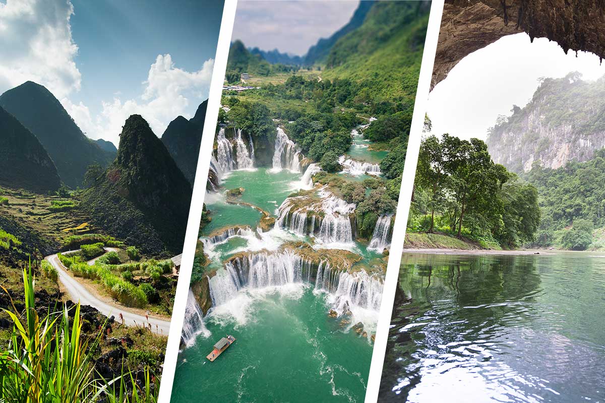
The roads connecting Ha Giang, Bac Kan, and Cao Bang pass through some of the most spectacular landscapes in Vietnam.
Many travelers consider this region the highlight of their journey through Southeast Asia. Towering limestone mountains, deep valleys, winding rivers, and remote villages create unforgettable scenery.
These routes connect two famous motorbike adventures: the Ha Giang Loop and the Northeast Loop. As a result, they offer some of the best riding experiences in northern Vietnam.
Several route options link Ha Giang, Ba Be Lake, and Cao Bang. Although each route is different, all of them deliver outstanding mountain scenery and authentic local experiences.
Route Overview
Trip Information
Distance:
- Classic Route: 360 km
- Border Route: 370 km
- Ba Be Lake Route: 310 km
Duration: 1–3 days
Road Types: Mountain roads, back roads, and national highways
Highlights:
- Limestone karsts
- Mountain passes
- Deep valleys
- Terraced rice fields
- Ethnic minority villages
- Remote landscapes
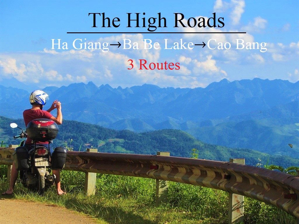
Three spectacular (but unpredictable) routes lead over the mountains from Ha Giang to Cao Bang
Choosing the Best Route
The journey between Ha Giang and Cao Bang offers three main route options.
Classic Route
The Classic Route follows the easiest and most popular roads. Therefore, it is ideal for first-time riders.
Border Route
The Border Route follows remote roads near the Chinese border. It offers dramatic scenery and very little traffic.
Ba Be Lake Route
The Ba Be Lake Route combines mountain roads, lake views, and national highways. It is perfect for travelers who want to visit Ba Be National Park.
In addition, several connecting roads allow riders to combine sections from different routes.
Road Conditions and Travel Tips
Although the scenery is spectacular, road conditions can change quickly.
Heavy rain often causes landslides, mud, and damaged pavement. Therefore, always check local weather conditions before departure.
Road improvement projects continue throughout the region. As a result, some sections may contain gravel, construction zones, or temporary detours.
Accommodation is available in most towns marked on the route. Small guesthouses and local hotels can usually be found in major settlements.
The routes remain accessible throughout the year. However, summer brings heavy rainfall, while winter temperatures can become very cold in the mountains.

Road QL4C between Meo Vac & Bao Lac offers some extraordinary views over rice terraces & mountains
Classic Route: Ha Giang → Meo Vac → Bao Lac → Cao Bang
Route Overview
Distance: 360 km
The Classic Route begins on the famous Ha Giang Loop before continuing southeast toward Cao Bang.
After leaving Meo Vac, riders follow QL4C through impressive mountain scenery and limestone valleys. The road eventually reaches Ly Bon, where the Nho Que River meets the Gam River.
From Ly Bon, continue east on QL34 toward Bao Lac.
Highlights Between Meo Vac and Bao Lac
This section offers beautiful views of rivers, mountains, and rice terraces.
Although road upgrades have improved conditions significantly, some repairs may still be underway. Therefore, riders should remain cautious.
Bao Lac provides several accommodation options and makes an excellent overnight stop.
Bao Lac to Cao Bang
From Bao Lac, continue southeast through Tinh Tuc and Nguyen Binh.
The scenery remains excellent throughout this section. However, road conditions can vary. Expect occasional potholes, rough pavement, and possible landslides after heavy rain.
Travelers heading to Ba Be Lake can leave QL34 and take DT212 south toward Cho Ra.

Road QL34 southeast from Bao Lac to Cao Bang has some rough patches but the scenery is excellent
Border Route: Ha Giang → Bao Lac → Pac Bo → Cao Bang
Route Overview
Distance: 370 km
The Border Route is the most remote option.
From Meo Vac, riders follow DT217 toward Khau Vai and the Nho Que River. The road climbs across limestone plateaus before descending into remote valleys.

Road DT217 winds up the hillside leaving Meo Vac & then heading southeast to Khau Vai & Bao Lac
Khau Vai to Bao Lac
Road conditions become more challenging after Khau Vai.
The route crosses the river and continues through rugged mountain terrain. Consequently, riders on automatic scooters may find some sections difficult.
However, the scenery is among the best in northern Vietnam.
The Agitated Dragon Road
East of Bao Lac, an unnamed road follows the Chinese border.
Many riders consider this one of Vietnam’s most exciting mountain roads. The route twists constantly through remote valleys and steep mountains.
One section features fourteen consecutive switchbacks. Today, many travelers know this pass as Mẻ Pia Pass.
Because of its dramatic layout, this road has become a favorite among experienced riders.

Looking down on one of the 14 switchbacks of the ‘Roller Coaster Pass’ on the ‘Agitated Dragon’ road
Pac Bo to Cao Bang
The route eventually joins the Ho Chi Minh Road near Pac Bo.
Before heading south, riders can visit Pac Bo Cave, one of Cao Bang’s most important historical sites.
Afterward, follow the smooth Ho Chi Minh Road directly into Cao Bang City.

Pac Bo Cave on the Chinese border is a fascinating historical sight in a beautiful natural setting
Ba Be Lake Route: Ha Giang → Da Vi → Ba Be Lake → Cao Bang
Route Overview
Distance: 310 km
The Ba Be Lake Route is the southern option connecting Ha Giang and Cao Bang.
This route combines scenic river valleys, mountain roads, and one of Vietnam’s most beautiful lakes.

The southerly route between Ha Giang & Cao Bang, via Ba Be Lake, passes particularly lush scenery
Ha Giang to Da Vi
Begin on QL34 through the Gam River Valley.
The scenery is lush and peaceful. Eventually, turn south onto DT176 toward Da Vi.
This narrow mountain road passes through isolated valleys and forested hills. Although beautiful, some sections can become muddy after rain.
Da Vi to Ba Be Lake
Da Vi sits beside a large reservoir and remains far from major tourist routes.
From here, continue east across mountains and dense jungle. The road eventually reaches the crossroads near Ba Be Lake.
Travelers can turn west to reach lakeside homestays and explore Ba Be National Park.
Ba Be Lake to Cao Bang
After visiting the lake, continue through Cho Ra and Na Phac.
The final section follows QL3, one of the most enjoyable highways in northern Vietnam.
Smooth pavement, mountain scenery, and light traffic make this an excellent finish to the journey.

Some sections of QL34 & DT176 can be very tricky conditions, but the bad patches are generally short
Final Thoughts
All three routes offer incredible scenery and unforgettable riding experiences.
The Classic Route is the easiest. The Border Route is the most adventurous. Meanwhile, the Ba Be Lake Route combines nature, culture, and comfortable riding conditions.
Whichever route you choose, the journey between Ha Giang, Ba Be Lake, and Cao Bang remains one of the greatest motorbike trips in Vietnam.

Stay at one of the homestays on Ba Be Lake before continuing on the excellent road QL3 to Cao Bang
0 Comment